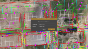
Virtual Surveyor has unveiled newly developed Auto-Flip Edges functionality that generates more accurate terrain surfaces from drone survey data. This innovative triangulation process is included in Version 8.7 of the popular Virtual Surveyor software package, along with upgrades in overall ease of use.
Virtual Surveyor is a robust surveying software that bridges the gap between drone photogrammetric processing applications and engineering design packages, enabling surveyors to derive topographic information from drone data needed by engineers for construction, mining, and excavation projects. The software combines drone orthophotos, digital surface models (DSMs), and/or LiDAR point clouds to create an interactive virtual environment where users generate CAD models, create cut-and-fill maps and calculations, or calculate volume reports.
The new Auto-Flip Edges algorithm is a significant improvement on the traditional method of generating triangular irregular networks (TINs) from elevation points extracted from drone surveys. The new process uses the same elevation points, but it also leverages terrain information between the points to optimize the placement of triangles by automatically flipping edges when needed. This results in a TIN that represents the actual terrain surface more accurately than traditional triangulation.
“Auto-Flip Edges enables Virtual Surveyor users to generate more meaningful and accurate CAD models from either drone imagery or LiDAR point clouds,” said Tom Op ‘t Eyndt, Virtual Surveyor CEO. “More accurate terrain surfaces will benefit surveyors working in any 3D mapping project, especially where soil volumes are important, such as excavation, construction, surface mining, and landfills.
”Virtual Surveyor found its new triangulation method generates a terrain match that is more accurate than traditional TIN creation methods. Even though the same elevation points are used, the accuracy of the created CAD model is enhanced because the Virtual Surveyor algorithm creates the triangles in a more precise representation of the topography.
This new technique also highlights the advantage of drone surveying over field surveys with GPS equipment or total stations, Op ‘t Eyndt explained, because field data sets do not contain the information between the elevation points making it impossible to find a better TIN edge fit than traditional TIN creation tools.
Virtual Surveyor will be demonstrating Version 8.7 at DJI AirWorks 2022 being held Oct. 10-12 in Las Vegas and at InterGEO 2022 on October 18-20 in Essen, Germany.
“Version 8.7 includes several other new enhancements designed for improved ease of use and a better overall user experience,” said Op ‘t Eyndt.These features include the following:
Faster File Navigation – The addition of a Search Box and Scroll Bar, and Favorites Star enable users to find specific files and directories more quickly and then mark them for repeated fast access.
Simplify Tool – Users can now reduce the number of vertices in their 2D lines, such as contours, and their 3D boundaries. This deletes extraneous vertex points for easier handling of the CAD model.
Material Editor – Stockpile reports are easier to read thanks to new Materials editing functionality, most notably the removal of fill colors so the material inside a stockpile is still visible while the colorized border remains.
Graticule Lens – To facilitate eyeball measurement of distances in projects, users can overlay a grid with measurements of their choosing, i.e., 10x10 meters, 50x50 meters, etc.
Two-Factor Authentication – To improve security, Virtual Surveyor now includes an enhanced identification protocol for the user to access the software.
Current subscribers to Virtual Surveyor will see their software updated to Version 8.7 automatically. To start a free 14-day trial of Virtual Surveyor and to view details of the Valley, Ridge, and Peak pricing plans, visit www.virtual-surveyor.com.