Combine the power of your brain to interpret complex topographies with the calculation power of the computer to create drone surveys in very short times.
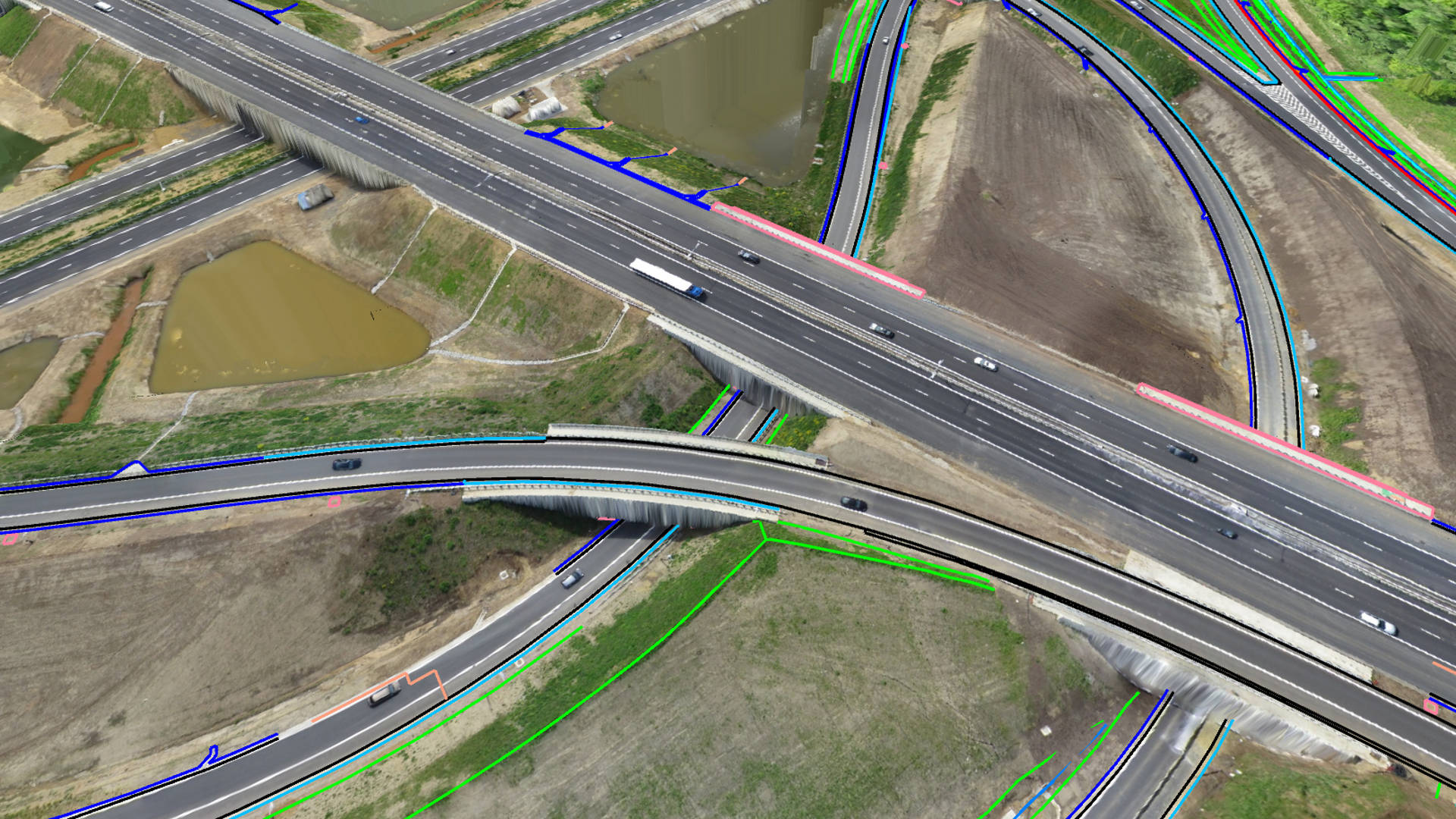
Create lightweight CAD models from drone data
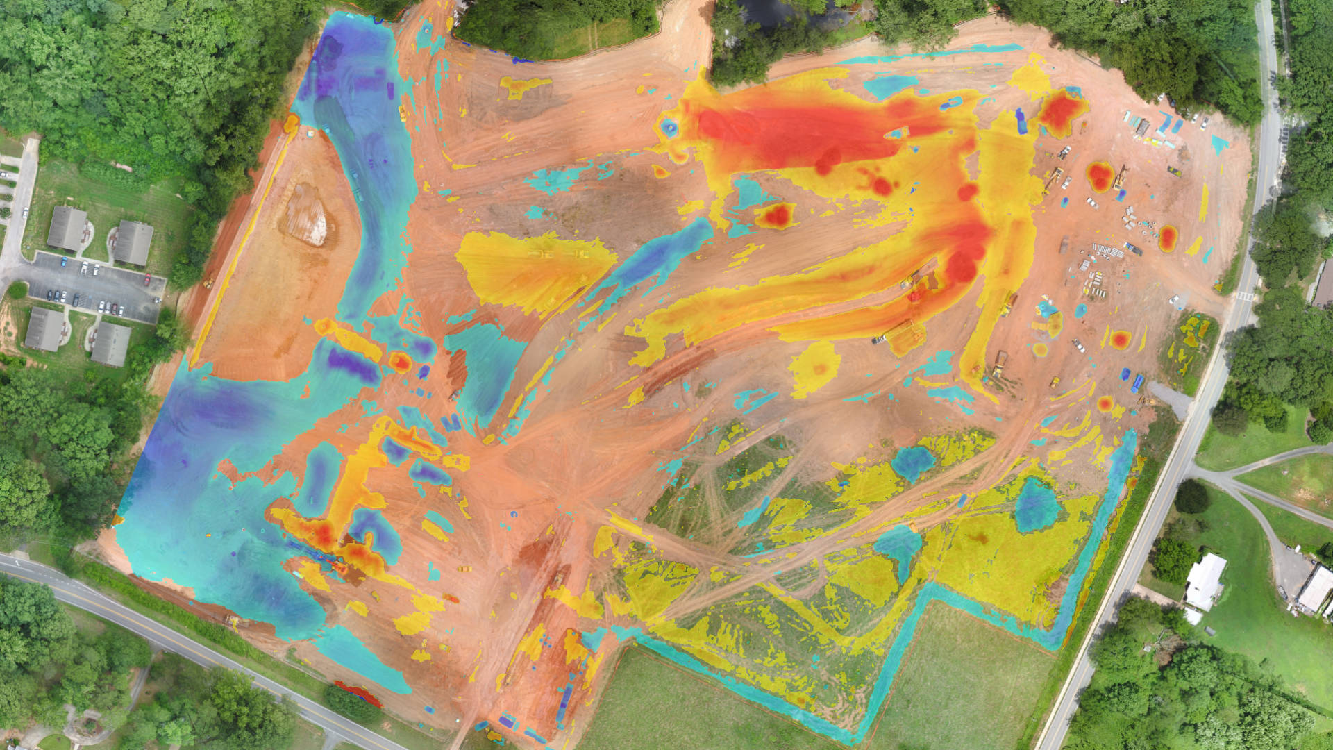
Know the true value of your stocks with drone data. Set materials, calculate volumes, tonnages and monetary value for a single project or over time.
Calculate stockpiles and generate PDF reports

With our flexible subscriptions you just pay for what you need.
Configure your plan with the functionality you need. For the time you need it. Not more. Not Less.

Use drone data for a more efficient and safer mine management. Create more accurate reports on excavations and stocks. Bridge the gap with your specialized mining software.
Extract breaklines, cut-and-fill and slope safety
Keep track of your construction project with multiple drone surveys. Compare with your baseline or design surface and determine how much work needs to be done.
Cut-and-fill, compare to design and document as-built

Use drone photogrammetry to model the topography of your site. Understand how water flows across the terrain today, and design changes to capture runoff and redirect water movement.
Understand and manage water flows
Transform drone-captured photos into a detailed virtual world of your waste site. Calculate airspace between the cap level, compaction rates and design access roads without setting foot on-site.
Monitor and shape your waste site as it grows


For Drone Photogrammetry. Turn drone photos into an accurate orthomosaic and elevation model. TerrainCreator eliminates the complexity of the photogrammetry process through an intuitive and visual processing workflow.

For Drone Surveying. Turn drone data into meaningful survey deliverables. VirtualSurveyor creates a virtual world where you work like a field surveyor using intuitive tools to produce topographic, planimetric, and quantity surveys in no time.