Newsroom

All the latest news about Virtual Surveyor

New Release

Virtual Surveyor Adds Local Coordinate System Functionality in Latest Release of Smart Drone Surveying Software

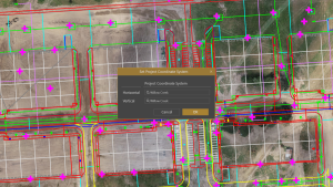
Virtual Surveyor has launched its 10.2 release, featuring Local Coordinate System functionality that transforms drone surveying. Users can project GPS imagery and LiDAR data into custom local systems, eliminating third-party software. This upgrade enhances survey projects in mining, construction, and excavation, where accuracy is crucial. With faster point gridding algorithms and user-friendly features like Save a Copy, Virtual Surveyor 10.2 elevates your surveying experience. Discover how this tool can improve your projects and accuracy where traditional systems fall short.

Read More »
New Release

Virtual Surveyor Offers Enhanced Functionality in Free Version of Drone Surveying Software

Virtual Surveyor has just released Version 7.4, enhancing its free Valley plan to allow users to create engineering CAD models from drone orthophotos and LiDAR data. This upgrade transforms the software from a simple viewing tool into a powerful resource for surveyors, enabling them to conduct topographic line surveys for small-area projects. With three pricing plans tailored for various project sizes, Virtual Surveyor empowers users to extract meaningful topographic information efficiently. Discover the new features, including improved layer management and interactive modeling tools, that make this software a must-have for professionals in construction, mining, and excavation.

Read More »
New Release

Virtual Surveyor Enhances File Access and Project Collaboration with OneDrive Integration in its Smart Drone Surveying Software

Discover how Virtual Surveyor is revolutionizing drone surveying with Version 10.1, featuring OneDrive integration for easy file access and collaboration. Save your data in the Cloud, accessible from anywhere, while collaborating with your team in real-time. With enhancements like Favorites Locations and improved Stockpile calculations, Virtual Surveyor is a powerful tool for construction, mining, and excavation. Don’t miss the chance to streamline your surveying projects—start your free 14-day trial today!

Read More »
New Release

Virtual Surveyor Adds Topographic Design Tools to Smart Drone Surveying Software with Focus on Temporal Concepts

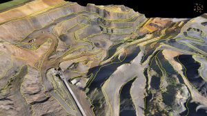
Virtual Surveyor has launched Version 10 of its drone surveying software, featuring innovative Topographic Design tools for visualizing terrain changes. The new Mountain plan allows for comparing multiple surveys, while the Peak plan offers advanced functions for designing rock walls, roads, and ponds directly from drone models. The enhanced Walk Mode lets you explore these future terrains in immersive 3D. Discover how these upgrades can transform your surveying projects—start your free 14-day trial today!

Read More »
Improvements

Virtual Surveyor Adds Productivity Tools to Mid-Level Smart Drone Surveying Software Plan

Virtual Surveyor has enhanced its smart drone surveying software by including the Productivity Tools suite in the Ridge plan, previously exclusive to the Peak plan. This update speeds up survey product creation from UAV images and LiDAR data, enabling faster generation of CAD models and stockpile inventories. With features like Guided Breakline Drawing and Low-Pass Point Grid, surveyors can enhance their workflows and accuracy. Discover how these tools can transform your surveying projects—start your free 14-day trial today!

Read More »
New Release

Virtual Surveyor Adds Planimetric Survey Functionality to Latest Release of Smart Drone Surveying Software

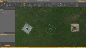
Virtual Surveyor has just released version 9.5 of its smart drone surveying software, introducing powerful planimetric survey capabilities that streamline the surveying process. Users can now quickly and accurately survey 2D features from drone orthophotos, enhancing efficiency in projects like construction and excavation. With innovative tools such as Move/Copy, Diagonal First Rectangle Drawing, and Mini Toolbars, surveying has never been easier. Plus, the software now converts LiDAR point clouds to digital surface models six times faster than before. Discover how these upgrades can transform your surveying experience and elevate your projects to new heights!

Read More »