MINING & QUARRYING
Efficiently apply drone data in your mining operations
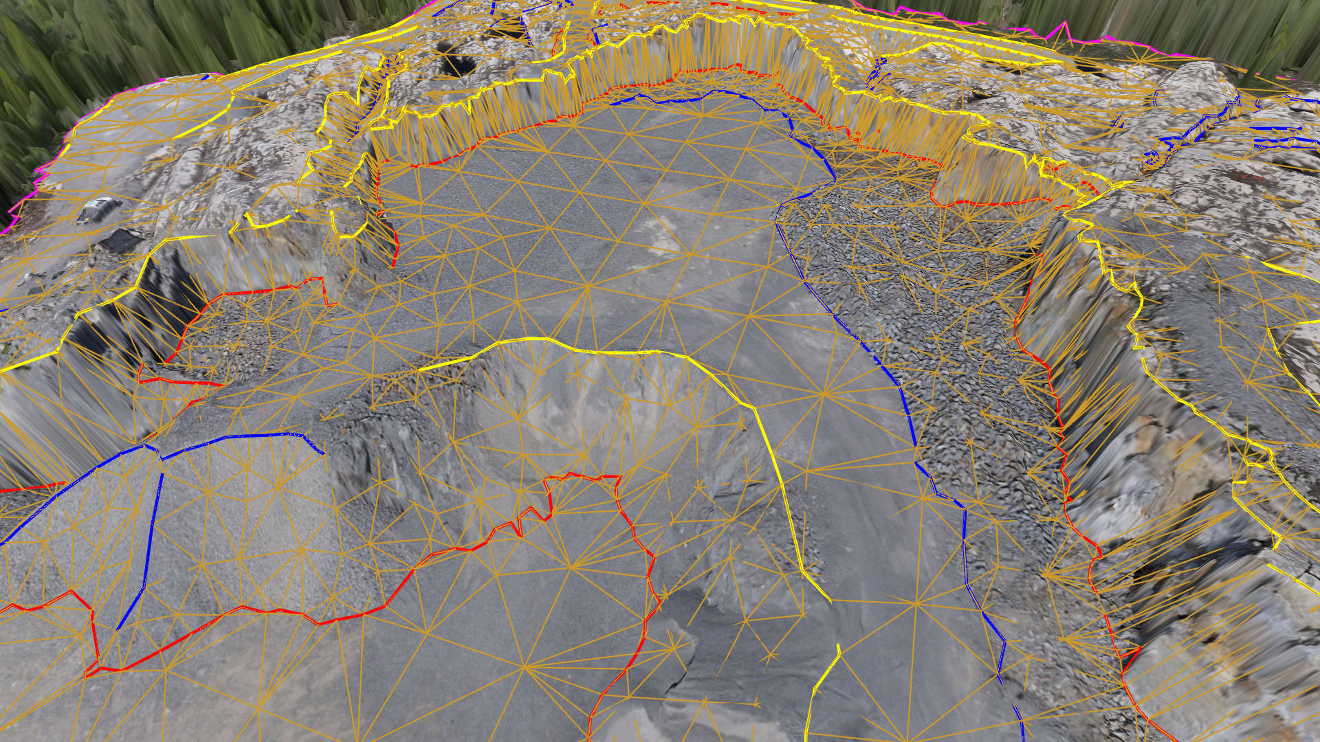
BREAKLINES & SURFACES
Breaklines are key topographic features in a mine site. Our intelligent breakline tool allows you to quickly capture them. Add a point grid to enhance the model, triangulate, and export the CAD surface model to your mining software.
Smart surveying tools...
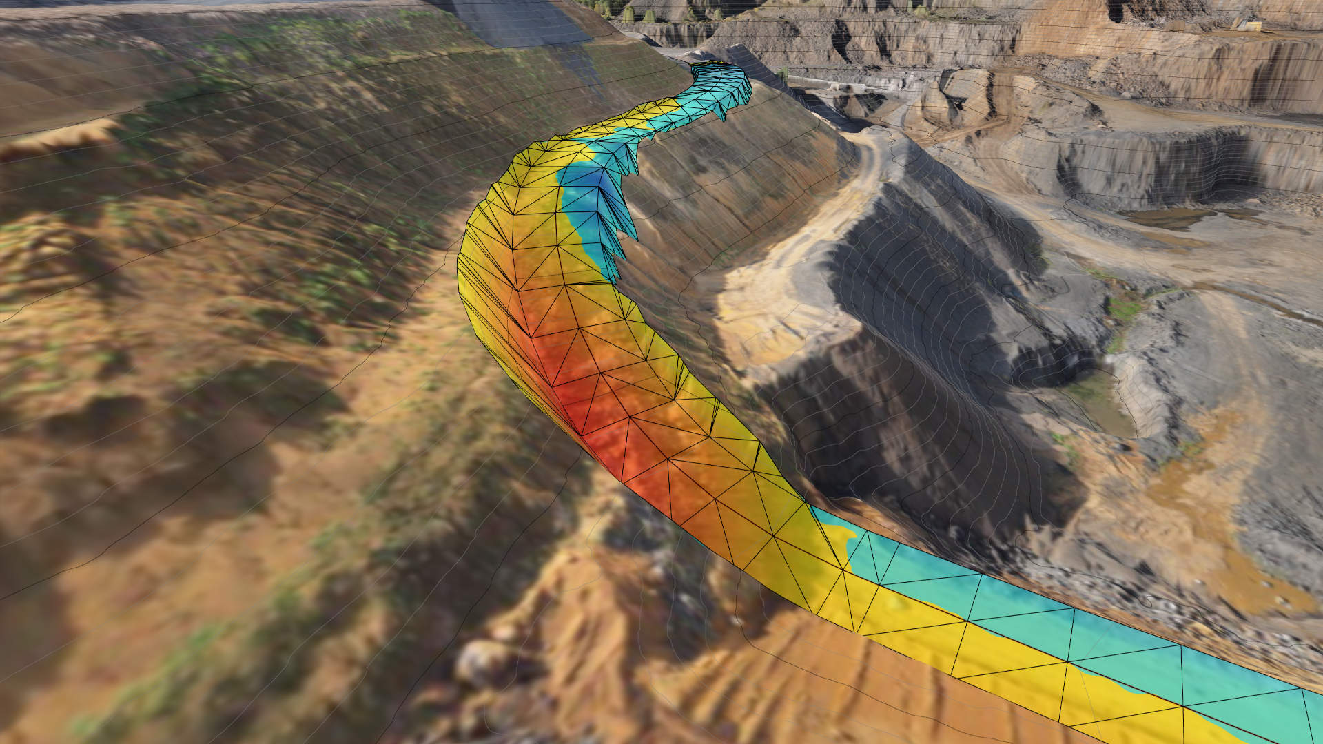
SLOPE SAFETY
Mines and quarries are fast changing environments where safety is always an important concern. Drone data provide instant insight into slope stability for walls and haul roads. Simply set a threshold and slopes exceeding it will be highlighted.
More on terrain lenses...
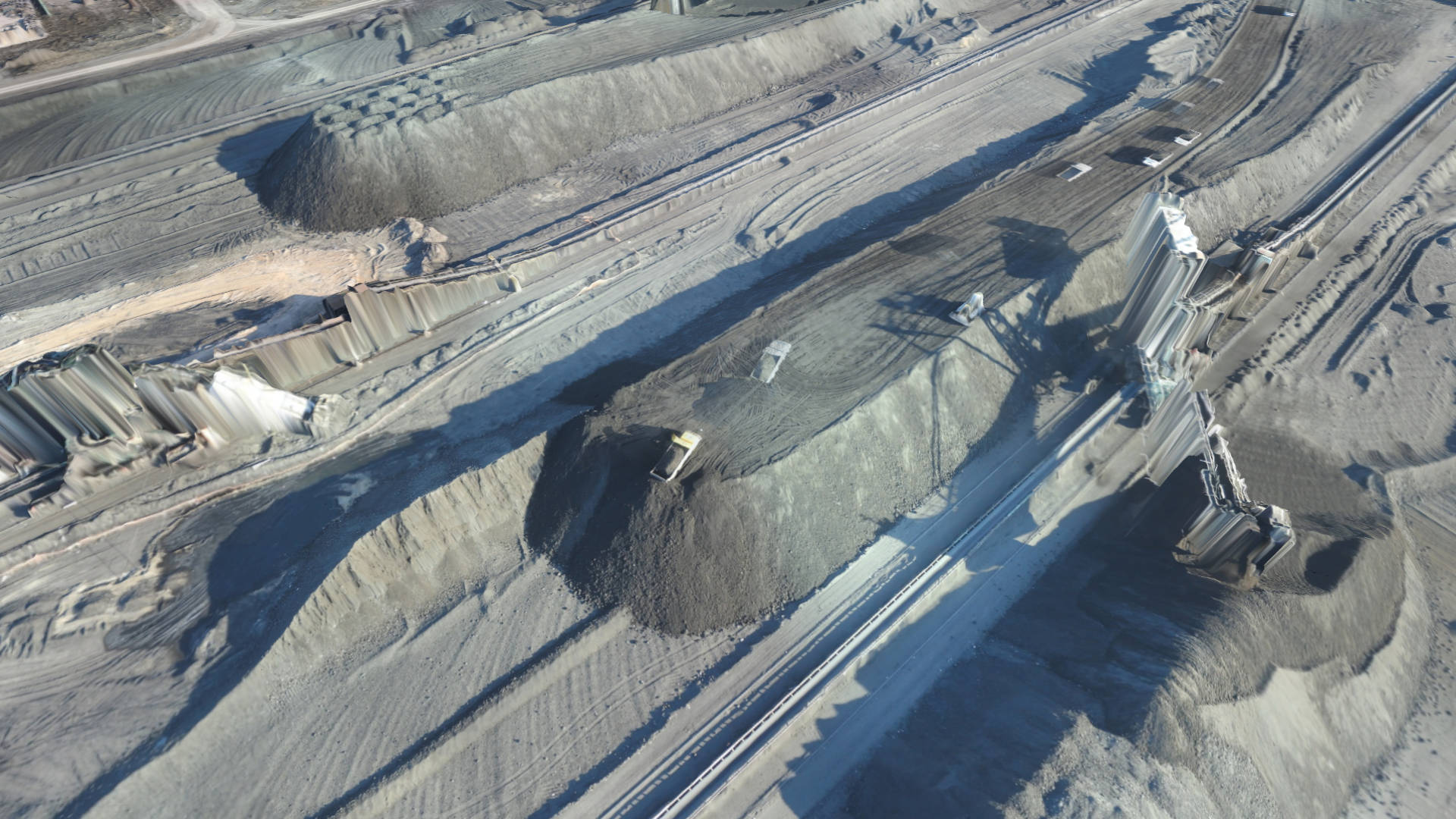
STOCKPILES
Drones can do more than supporting your mining excavation operations. Drones can also help to monitor the quantity and value of the produced material on site (lignite, coal, sand, ...) before it is used or sold.
More on volume tools...
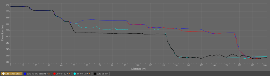
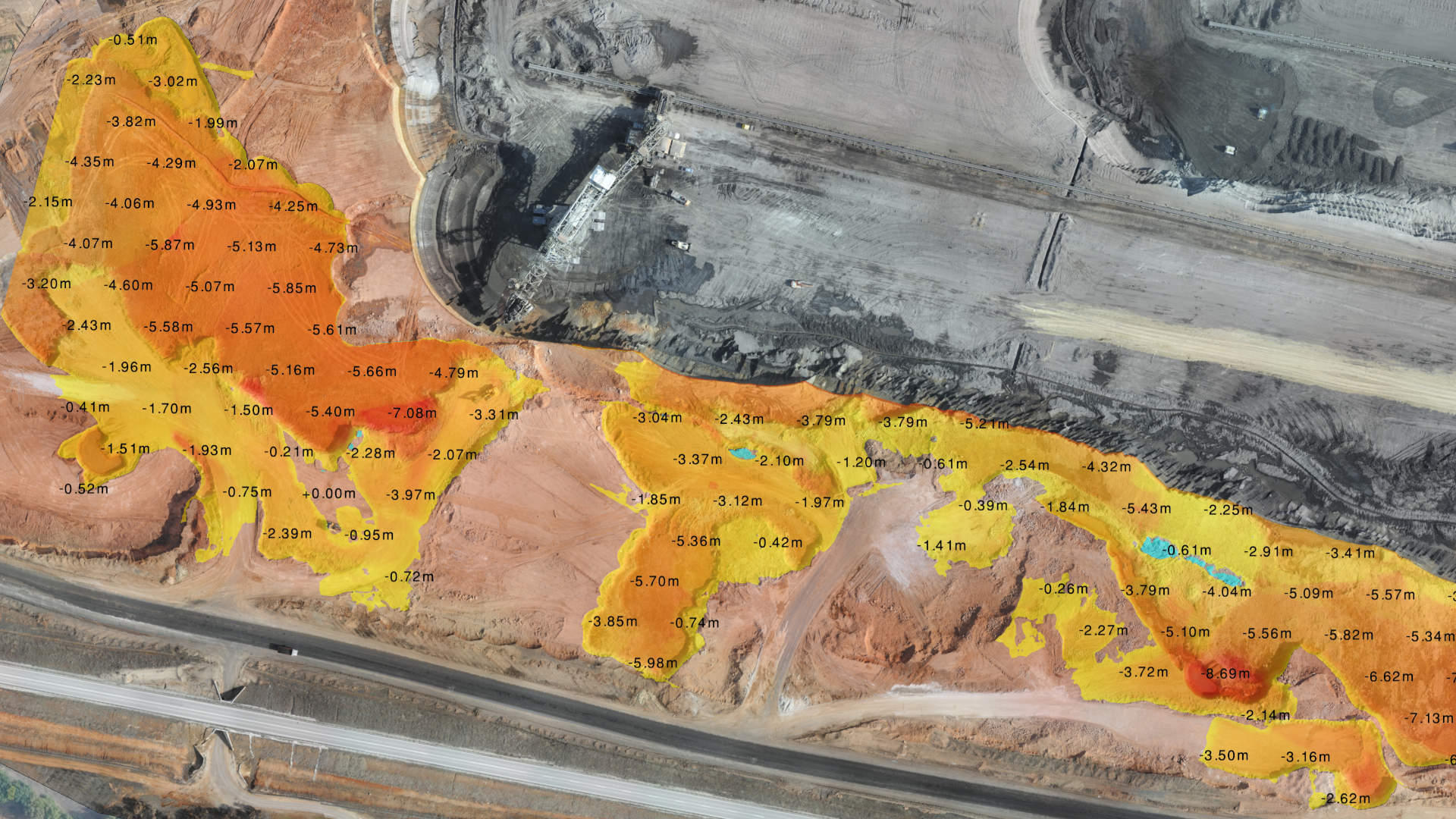
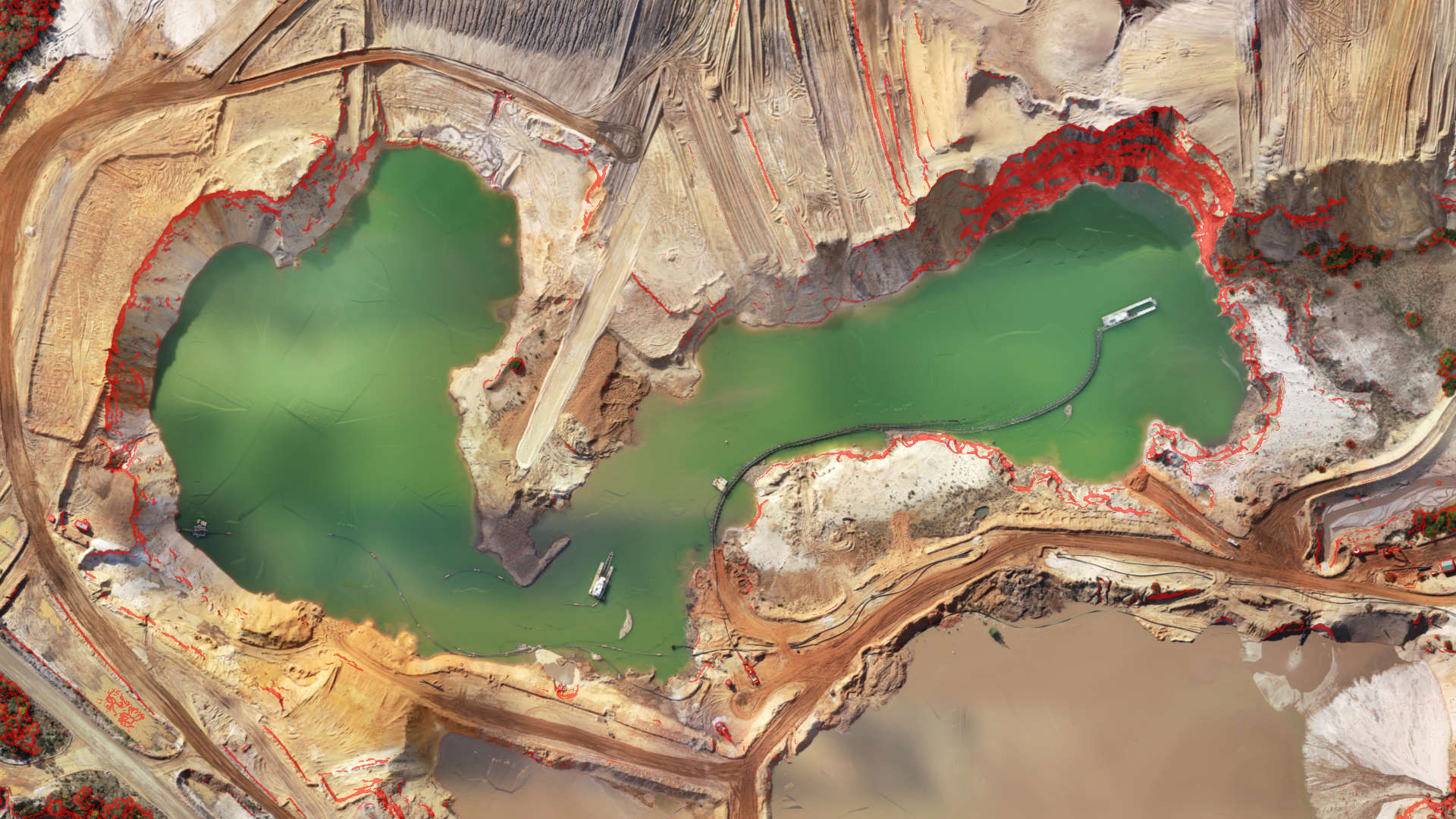
EXCAVATED VOLUMES
Calculate volume differences in seconds and identify areas of change between drone surveys taken at different points in time. Visualize where material is taken away or added, or identify areas without change.
Remove machines first...
DESIGN ACCESS ROADS
As your mine is excavated, you will need to continuously construct access roads to safely haul material out. Design these haul roads with proper slopes, embankments and safety berms directly on top of your drone data.
Learn the details...