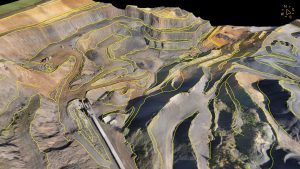
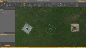
Calculating and reporting stockpile inventories are now easier and faster in the latest version of the Virtual Surveyor drone surveying software. Virtual Surveyor Version 8.2 allows users to accurately calculate stockpile volumes in drone imagery with just a few mouse clicks and then generate a professional PDF report detailing material tonnage and value.
“The stockpile inventory workflow is now complete in Virtual Surveyor – a huge time saver for users,” said Tom Op ‘t Eyndt, Virtual Surveyor CEO. “Before Version 8.2, users could quickly calculate stockpile volumes, but creating a professional looking report from those numbers was time consuming. Now the entire workflow is seamless and fast.”
The enhanced stockpile inventory functionality saves significant time at any site where materials are extracted, stored, or separated – open pit mines, aggregate quarries, lumber mills, recycling centers, and waste disposal operations.
“This new capability lets site operators easily report the tonnage and value of stockpile materials – which is the information organizations really need,” said Op ‘t Eyndt.
Virtual Surveyor is a powerful surveying software that bridges the gap between drone photogrammetric processing applications and engineering design packages, enabling surveyors to derive topographic information from drone data needed by engineers for construction, mining, and excavation projects. The software presents an interactive onscreen environment with drone orthophotos, digital surface models (DSMs), and/or LiDAR point clouds where users generate CAD models, create cut-and-fill maps, and calculate volume reports.
Efficient volume calculation has been a Virtual Surveyor feature for several years. To do this, the site operator collects drone imagery and then converts the data into a 3D surface model in the software. The user then simply delineates a pile of sand, gravel, lumber, or other material onscreen with the mouse. The software even allows the user to eliminate equipment from the scene – such as conveyors – to get a precise stockpile calculation.
“Generating stockpile reports can now be done at regular intervals with our time feature,” said Op ‘t Eyndt. “Create another time step in your project, add your new drone survey and produce a new stockpile report in minutes.”
The user can also set up a Project Template with a Materials Library and layer structure for repeated use. For the Library, the user enters the name of each material – such as Sand, Fine Gravel, Coarse Gravel, etc. – and a density for each. For instance, the typical weight of dry sand is 1.6 tons per cubic meter. Next, the user adds current pricing in euros or dollars for each ton of that material. This value can easily be changed in the Library as commodity prices vary.
As Virtual Surveyor performs stockpile volume calculations, the user simply specifies the material in each pile, and the software determines the weight and value based on the data in the Materials Library.
The new Stockpile Inventory functionality is included in the Virtual Surveyor Ridge and Peak editions. The Peak package gives users the added ability to update inventories for periodic reporting. Current subscribers to Virtual Surveyor will see their software being updated to Version 8.2 automatically. To start a free 14-day trial of Virtual Surveyor and to view details of the three pricing plans, visit www.virtual-surveyor.com.