Virtual Surveyor Offers Enhanced Functionality in Free Version of Drone Surveying Software

Virtual Surveyor has just released Version 7.4, enhancing its free Valley plan to allow users to create engineering CAD models from drone orthophotos and LiDAR data. This upgrade transforms the software from a simple viewing tool into a powerful resource for surveyors, enabling them to conduct topographic line surveys for small-area projects. With three pricing plans tailored for various project sizes, Virtual Surveyor empowers users to extract meaningful topographic information efficiently. Discover the new features, including improved layer management and interactive modeling tools, that make this software a must-have for professionals in construction, mining, and excavation.

In release 7.4, Virtual Surveyor has added new functionality to the free pricing level of its popular drone surveying software. The “Valley” plan of Virtual Surveyor now allows users to create engineering CAD models from drone orthophotos and/or LiDAR data sets.

“Originally offered as a free viewing tool for imagery and elevation models captured by unmanned aerial vehicles (UAVs), our Valley software plan now enables surveyors to create topographic line surveys for small-area projects,” said Tom Op ‘t Eyndt, Virtual Surveyor CEO.

Available under three pricing plans, the Virtual Surveyor software enables surveyors to derive topographic information from drone data that engineers need for construction, mining, and other excavation projects. The software has become popular among surveyors and engineers because its tools allow them to work effectively with drone data.

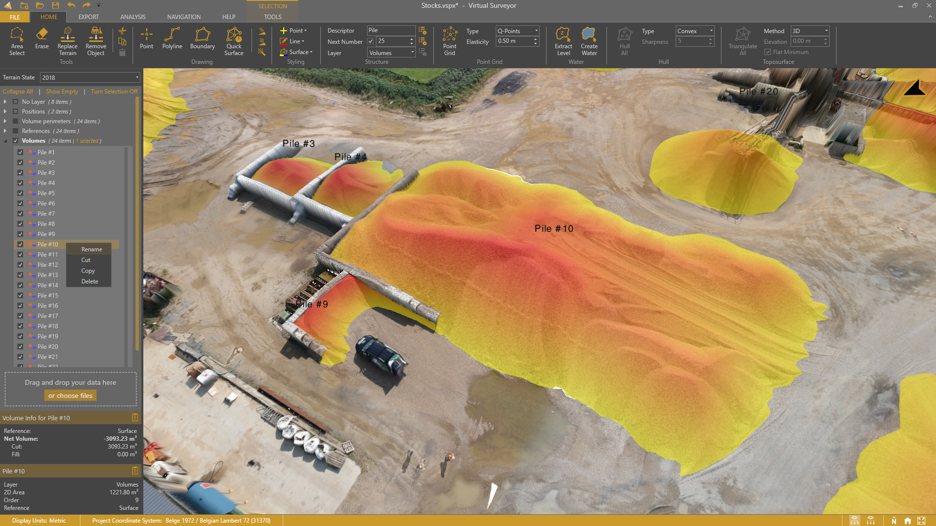
Virtual Surveyor generates an interactive onscreen environment where the surveyor selects survey points and breaklines to create a highly accurate lightweight CAD model for further use in engineering design packages. When the surveyor wants to calculate volumetric change directly in Virtual Surveyor using all data points, like stockpiles or a cut/fill map, the software creates a clean terrain model to remove conveyors and machines through simple clicking.In addition to upgrading the free Valley plan, Virtual Surveyor 7.4 has changed the names and enhanced capabilities of its other purchase plans. The three plans are:

Valley (Free) – Create CAD models from drone images or LiDAR for topographic surveying applications in small areas.

Ridge – Create advanced topographic and quantity surveys, including digital surfaces and contours, as well as stockpile volume calculations, from drone data for advanced surveying projects.

Peak – Designed for large-area projects, this plan includes Productivity Tools, such as intelligent gridding and guided breakline generation that speed processing. Most importantly, Peak enables surveyors to measure and track cut-and-fill progress at construction, mining, and other excavation sites over time.

“All Virtual Surveyor plans now empower surveyors to extract meaningful topographic information from their drone data,” said Op ‘t Eyndt.

Virtual Surveyor 7.4 also includes other functionality improvements that span all three pricing levels, making the software faster and easier to use. Most notably, users can now easily rename layers and items, and move items between layers through drag-and-drop. Download the free Valley application today and see what else is new in the Virtual Surveyor smart drone mapping package.

Current subscribers to Virtual Surveyor will see their software being updated to Version 7.4 automatically. To start a free 14-day trial of Virtual Surveyor and to view details of the three pricing plans, visit www.virtual-surveyor.com.
Share:

More Posts

Virtual Surveyor Drone Surveying Software Simplifies Workflow for Earthworks Monitoring at Construction Sites

Virtual Surveyor has unveiled Version 7.3 of its drone surveying software, revolutionizing earthworks monitoring at construction sites. This update streamlines the cut-and-fill mapping process, allowing construction managers to swiftly compare drone imagery with design plans. With features like the new Remove Object tool, users can easily eliminate extraneous items from surface models, ensuring accurate volume calculations. Additionally, the Spot Heights feature provides precise terrain elevation values, enhancing project oversight. Discover how Virtual Surveyor transforms construction workflows and empowers professionals to efficiently track earthworks progress, ensuring projects stay on schedule and within budget. Explore the latest innovations today!

Newest Virtual Surveyor Software Highlights Dangerous Slope Angles in Sand Pits, Quarries, Escarpments

Virtual Surveyor has unveiled an exciting new feature in Version 7.2 of its drone surveying software: the Slope Threshold lens. This innovative tool automatically highlights dangerous slope angles in sand pits, quarries, and escarpments, significantly enhancing operational safety. “With the click of a button, operators can see precisely where escarpments have exceeded user-specified slope angles,” says CEO Tom Op ‘t Eyndt. This update not only improves safety but also streamlines the surveying process, allowing users to create highly accurate topographic models faster than ever. Discover how these advancements can transform your surveying projects and ensure a safer working environment.

Virtual Surveyor Streamlines Volumetric Calculations for Stormwater Retention Ponds, Basins & Quarries

Virtual Surveyor has unveiled Version 7.1 of its innovative drone surveying software, revolutionizing volumetric calculations for stormwater retention ponds, quarries, and mine pits. With new features like Extract Level and Create Water, users can now delineate water bodies with a single click, significantly enhancing accuracy and efficiency. This update builds on previous enhancements, allowing for rapid volume difference calculations and seamless integration with CAD software. As Tom Op ‘t Eyndt, CEO of Virtual Surveyor, states, “Volumetric calculations involving water bodies can be performed much faster and more accurately.” Discover how this powerful tool can transform your surveying projects!

Send Us A Message

Great! We’ve received your information.