Virtual Surveyor has significantly enhanced the data storage, remote file access, and project collaboration functionality of its popular smart drone surveying package with seamless integration for Microsoft Office OneDrive accounts. This enables Virtual Surveyor users to inexpensively save data in the Cloud for access anywhere and to easily work on projects with teams.
Virtual Surveyor software provides users an end-to-end workflow to conduct 3D surveys from drone imagery representing a single point in time, a span of time, and a planned design in the future. Available today in the new Virtual Surveyor Version 10.1, the OneDrive integration, which includes Microsoft SharePoint, leverages Cloud storage capabilities that many users already have. In an earlier software release, Virtual Surveyor introduced integration with Dropbox.
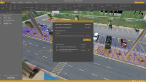
“Our objective with OneDrive integration is to make project access easy and affordable by using Cloud storage many users already pay for,” said Tom Op ‘t Eyndt, Virtual Surveyor CEO. ”With OneDrive, there is no special configuration by the user; Virtual Surveyor project data can be saved to Cloud Locations just like Word or Excel files.
”This means data follows Virtual Surveyor users to any computer where they work. Just as importantly, users can set up Team Accounts with shared folders accessible to an unlimited number of Team members in remote locations. They can access and work with Project files from any computer running the Virtual Surveyor desktop app and save their changes back to the Cloud.
“A major advantage of both OneDrive and Dropbox is that they synchronize locally on the computer where the user is working, so there is no latency when Virtual Surveyor software accesses the Project data,” said Op ‘t Eyndt.In general, Cloud storage eliminates the worry of losing valuable data either by accidental file overwrite or deletion. OneDrive and Dropbox automatically and continually back up files to the Cloud where users can recover them if the data disappears from the computer hard drive.
Two other new features in Virtual Surveyor V10.1 are designed to improve ease of use. Users can now add local, network and cloud locations as Favorites Locations to make it easier to find surveying projects they work on frequently.
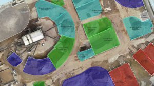
Another enhancement is in Virtual Surveyor’s extremely popular Stockpile functionality which enables users to easily calculate the volume and tonnage of materials in stockpiles surveyed with drone imagery. For very large facilities with many stockpiles of different materials (sand, aggregate, etc.), users can now assign a Material through a search function instead of having to scroll through a long list.
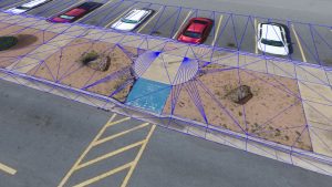
Virtual Surveyor V10.1 remains an incredibly robust tool for creating surveys from drone images and LiDAR point clouds for use by engineers in construction, surface mining, and excavation projects – without the need for third-part software. The package includes surveying capabilities, photogrammetric functionality, and topographic design tools in a series of progressive subscription plans differentiated by Time for past, present, and future 3D terrain surveys.
To start a free 14-day trial of Virtual Surveyor and to view details of the Valley, Ridge, Mountain, and Peak pricing plans, visit www.virtual-surveyor.com.