Virtual Surveyor has introduced Dropbox integration in Version 8.0 of its popular drone surveying software. This means Virtual Surveyor users can now access their project files from anywhere while enjoying easy and affordable collaboration with team members and file sharing with external clients – even in low-bandwidth situations.
“Dropbox integration gives Virtual Surveyor users the best of both worlds – the advantages of desktop software combined with cloud storage and access…without losing control of their data,” said Tom Op ‘t Eyndt, Virtual Surveyor CEO.
Virtual Surveyor is a powerful surveying software that bridges the gap between drone photogrammetric processing applications and engineering design packages, enabling surveyors to derive topographic information from drone data needed by engineers for construction, mining, and excavation projects. The software presents an interactive onscreen environment with drone orthophotos, digital surface models (DSMs), and/or LiDAR point clouds where users generate CAD models, create cut-and-fill maps, and calculate volume reports.
“Some drone surveyors are spending tens of thousands of dollars or euros to put their data in cloud mapping applications that give them a little bit more then simple viewing functionality,” said Op ‘t Eyndt. “And those applications lock them into using that specific software product forever to maintain access to their files.
”With prices starting at 10 dollars/euros per month, Dropbox is a more cost-effective and scalable solution. More importantly, Dropbox is a stand-alone cloud service which allows Virtual Surveyor users (even the one on the free Valley plan) to maintain complete control over their data. Project files remain stored in the cloud as long as users keep their Dropbox account…even if they stop using Virtual Surveyor.
Affordable, cloud-based Dropbox technology offers four important benefits to Virtual Surveyor users:
Access Anywhere – For users with up-to-date Virtual Surveyor cloud licenses, project files follow them and may be accessed from any computer with an Internet connection simply by logging into the user’s software account. Dropbox downloads just the project files needed to run specific Virtual Surveyor functions. Project files are always synced with the cloud, and Dropbox automatically clears space on the hard drive by moving unused files to the cloud.
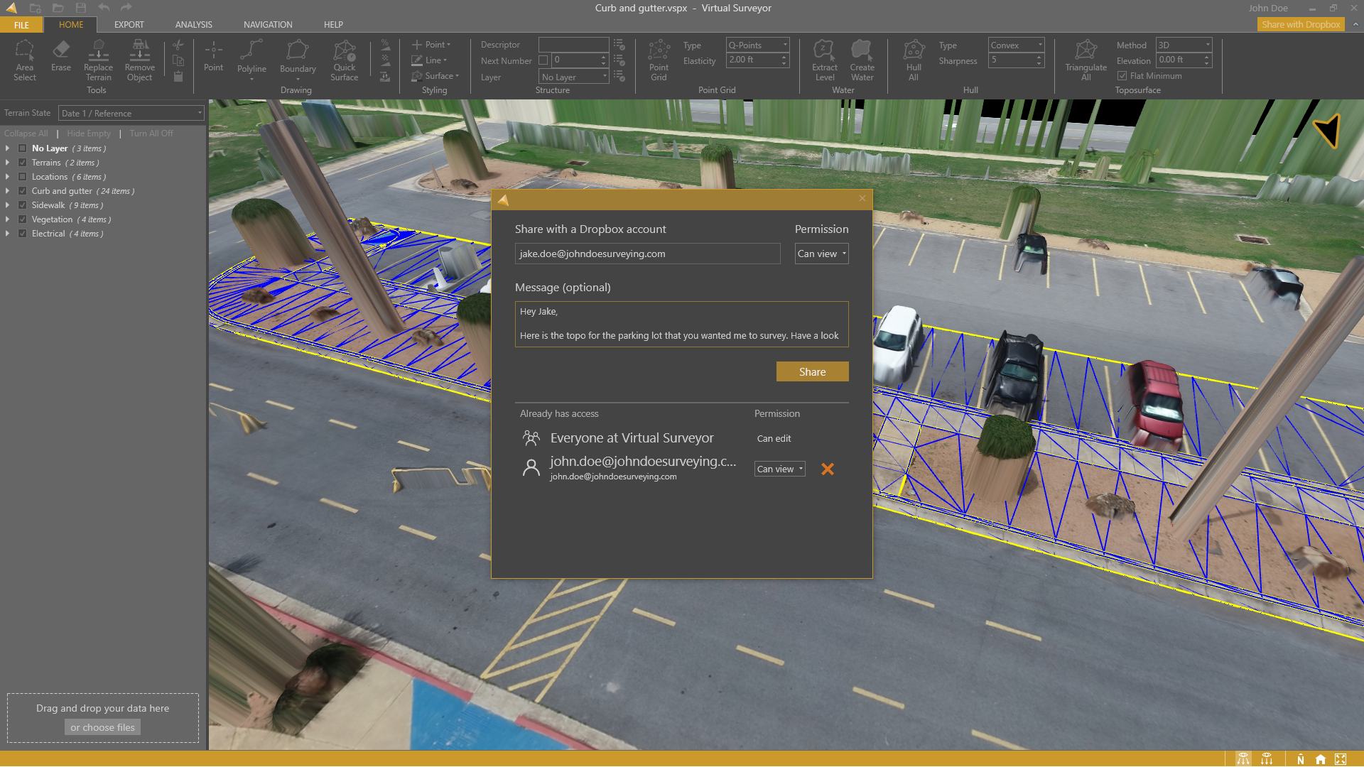
Collaborate in Teams - Team folders can be created to centralize files and allow collaboration across the enterprise. Virtual Surveyor users can set up a Team folder with preferred preferences to organize and structure data sets. The data owner can restrict access to specific files and assign certain rights, such as view-only or edit, to individual users or groups of users. Virtual Surveyor ensures only one user at a time can edit content to avoid editing conflicts through the newly created View-only mode.
Share Externally – Virtual Surveyor projects can be shared with clients or external team members who may be granted full editing or view-only rights, which can be revoked at any time. The Virtual Surveyor user maintains control over the files and data.
Low-Bandwidth Environments – Even in situations with poor-quality Internet connections, such as on the client’s job site, Virtual Surveyor users experience the power of their desktop software while knowing their files are in sync. Dropbox makes sure copies of the orthophoto and elevation model are available locally on the computer while synchronizing changes to project files in the cloud.
In addition, Virtual Surveyor users will experience the common cloud storage benefits provided by Dropbox: Automatic File Backup and File Version Control. Files are never accidentally deleted or written over, and previous versions may be retrieved at any time.
The new Dropbox functionality is included in the Virtual Surveyor Ridge and Peak editions, as well as the free Valley package. Current subscribers to Virtual Surveyor will see their software being updated to Version 8.0 automatically.